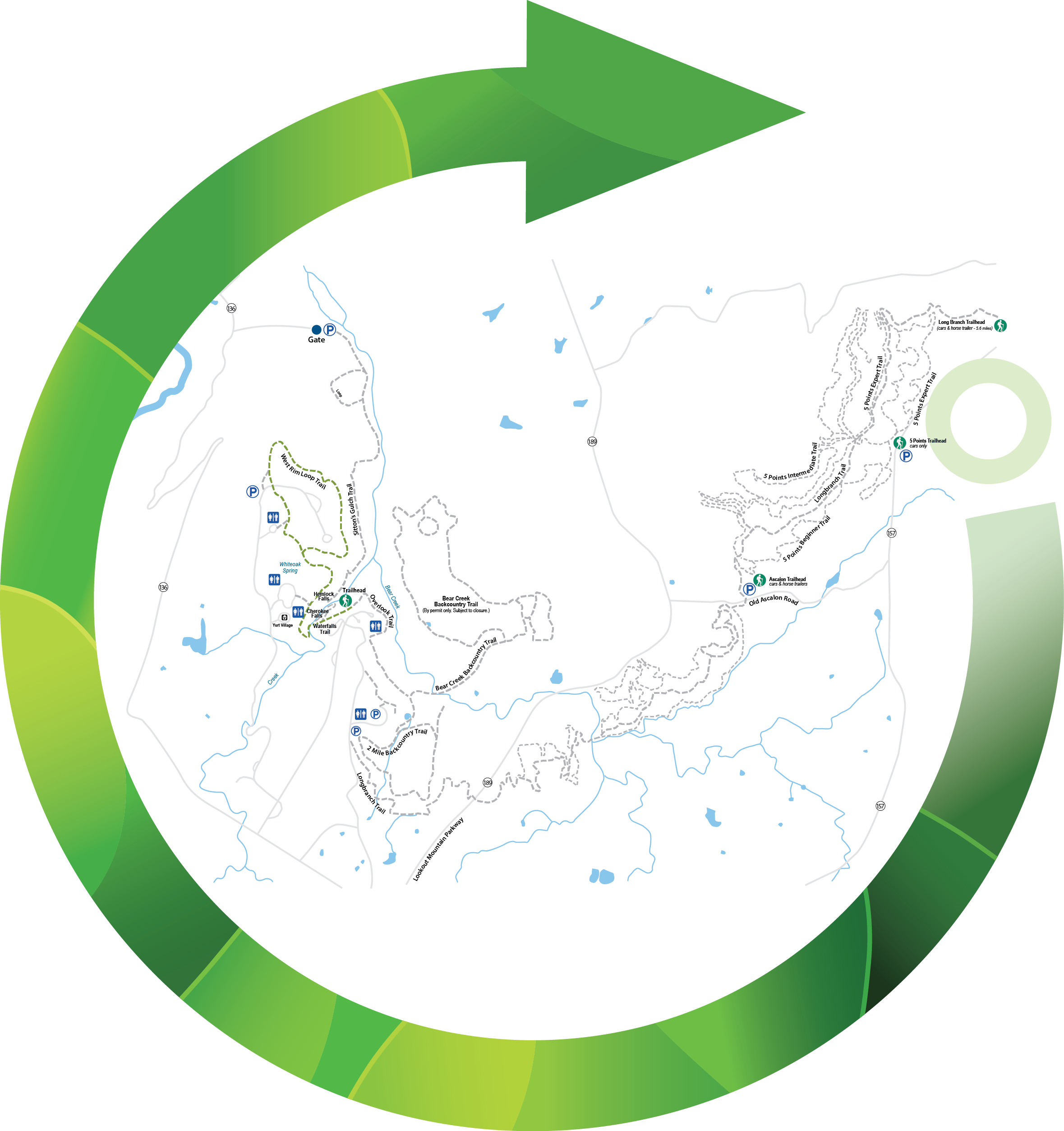
The West Rim Loop Trail is a five-mile lollipop style hike providing several overlooks that showcase the park’s rugged geology, deep canyons, dense woodland, and epic views. Marked by unmistakable yellow blazes, the occasionally rocky and root-ridden trail is best accessed from the Main Trailhead.
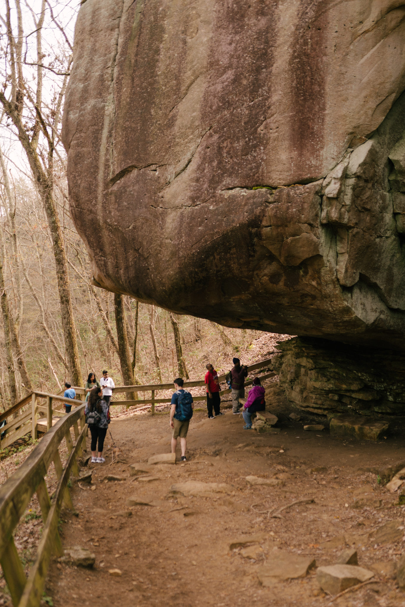
Within the first 0.4 miles, the trail descends to its lowest point of 1,625 feet above sea level. For the next 0.2 miles, the trail traverses a series of switchbacks as it works back up from the Daniel Creek bridge. At 0.6 miles, the trail passes a small cave and swings north to follow the southwest rim of the canyon as it heads toward the beginning of the loop.
The loop begins at 1.2 miles. We recommend bearing left to take the loop clockwise. While it may seem like you are saving the rim views for the second half of the hike – which you are – this pathway makes the ascent to the trail’s highest point more gradual and less steep. The descent back to the loop’s end will be more enjoyable and allow you to conserve energy for the moderate to difficult hike. For the next 0.8 miles, it’s a steady climb to the pinnacle of 1,930 feet above sea level at the 2.0-mile mark.
After a photo opportunity and a well-deserved water and snack break, continue along the trail, heading southeast along the rim. In this section, hikers should use caution and have a high awareness of the proximity to the rim’s edge.
Just before 3.0 miles, another photo opportunity at a rocky outcropping will provide the full scope and splendor of the canyon that was carved by flowing water over hundreds of thousands of years. After this, the trail takes a true southerly bearing and continues to ascend.
At around 3.2 and 3.3 miles are two more great photo locations as the trail swings west. The 3.5-mile mark means a wooden foot bridge is near, along with the end of the loop. As the trail meets back up with the original route, retrace your steps through the southwest section of the canyon, past the yurt village, over the bridge, and back to the main trailhead.


 Distance: 5 mi
 Difficulty: moderate to strenuous
 Directions
; w.print(); )


 2 months ago


