The trailhead is
accessible from Ellijay by taking the Chatsworth, GA Highway 52/2 northwest out
of Ellijay. Take a right on Gates Chapel Road, then turn right onto Forest
Service (FS) Road 241. Coming from Dalton, Chatsworth and other points west,
take GA Highway 52/2 East to Sam Hill Road/Highway 64, turning left. Follow Sam
Hill Road until it joins Gates Chapel Road, taking a left. Follow to Forest
Service 241 and turn right. The trailhead is approximately one mile on the
right, with parking.
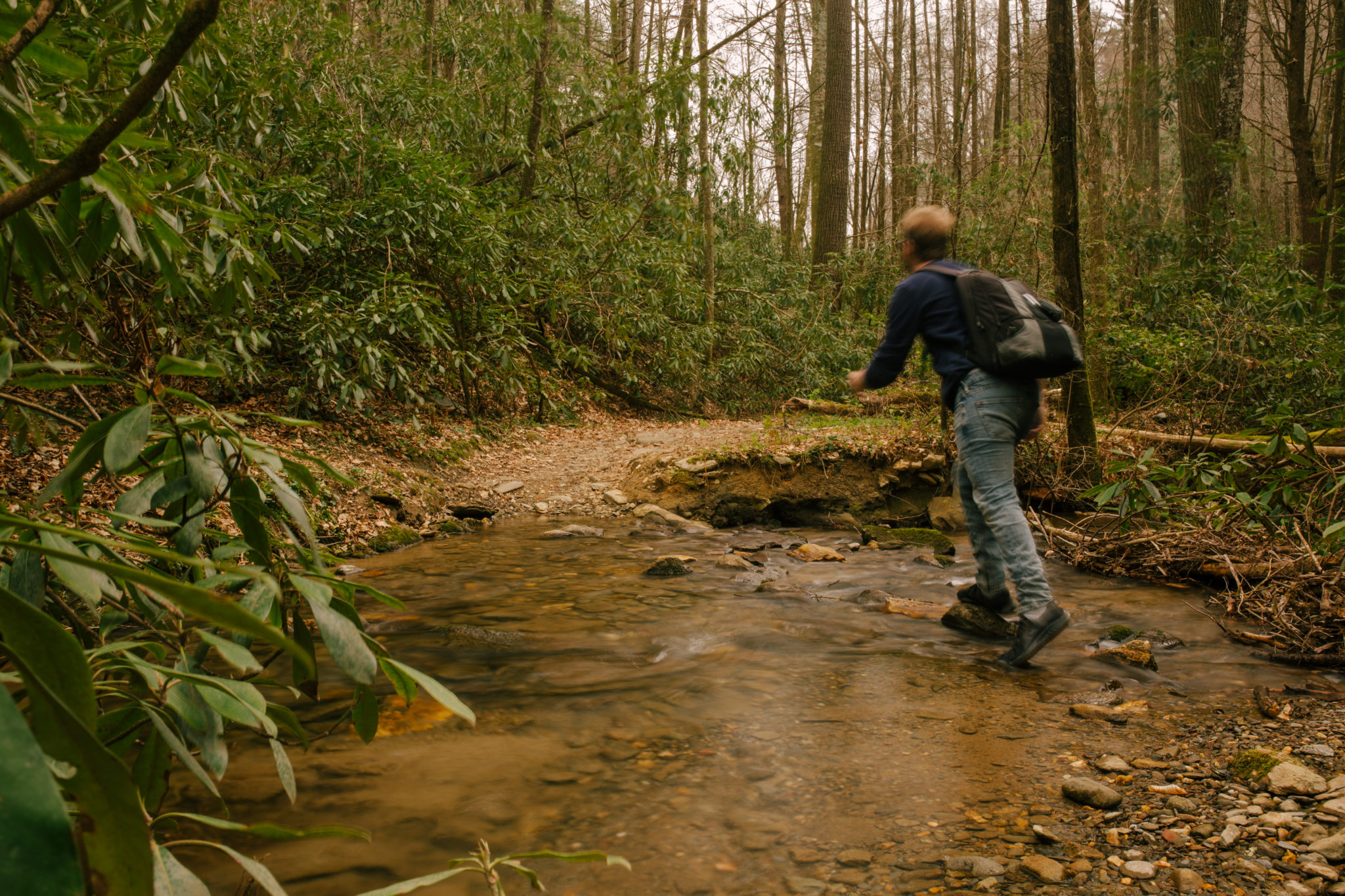
Upon entering the trail, Bear Creek will be running to your
right, the stream flowing down from the peak of the hilltops.
Prepare to get the blood pumping as you will ascend during
the first mile of this hike. The exciting part of this section is the constant
sounds of Bear Creek that keep you company. Mountain biking is also permitted
on Bear Creek Trail, so keep an eye out for faster moving companions.
At mile 0.2 the trail joins with the Pinhoti Trail as you
continue upstream. The damp valley is home to many Georgia hemlocks, along with
standing and fallen pines. By the time you reach mile 0.5 you will have crossed
Bear Creek several times. Occasionally you will experience an opening in the
forest, allowing for views of the skies.
As you approach mile 0.8, you will reach the surprise of
this trail, the Gennett Poplar. The giant poplar tree is the second largest in
Georgia, measuring 18 feet in diameter. The tree is really a tulip, though, or
yellow poplar, with orange and yellow flowers in the spring.
Continuing on to mile 1.0, you have a choice to extend the
Bear Creek hike to 6.4 miles by following the trail straight. To stay on the
Loop, the Pinhoti Trail leaves Bear Creek Trail to the right. The cut-through
on Pinhoti is brief; it continues to the northwest as you make the turn to the
right and head back down the ridge.
The descent back to the trailhead is made easier by the
grassy, more open path, which was part of a former road that was seeded,
creating a linear clearing. Here you may see wildlife such as birds, turkey,
and deer crossing the path in these open canopies. There are several of these
clearings along the switchbacks heading down the Loop.
Ending the Loop at the 2.9-mile mark, you will cross Bear
Creek one last time. Only this time, be prepared to dip your feet in, as this
is one of the wider points of the creek.


 Distance: 2.9
 Difficulty: moderate
 Directions


 2 months ago


