This green blazoned trail is the perfect summer day hike. There are multitudes of activities to enjoy on this trail, from having a picnic to swimming or even fishing. Wintertime, though, may present more challenges, with the amount of stream crossings or ice. If you like waterfalls, this is a quick way to get your fill, with five different falls along the way. Three of these are easy to access while the other two will take you off the beaten path. You’re encouraged to pack an extra pair of socks and hiking poles for these aquatic encounters.
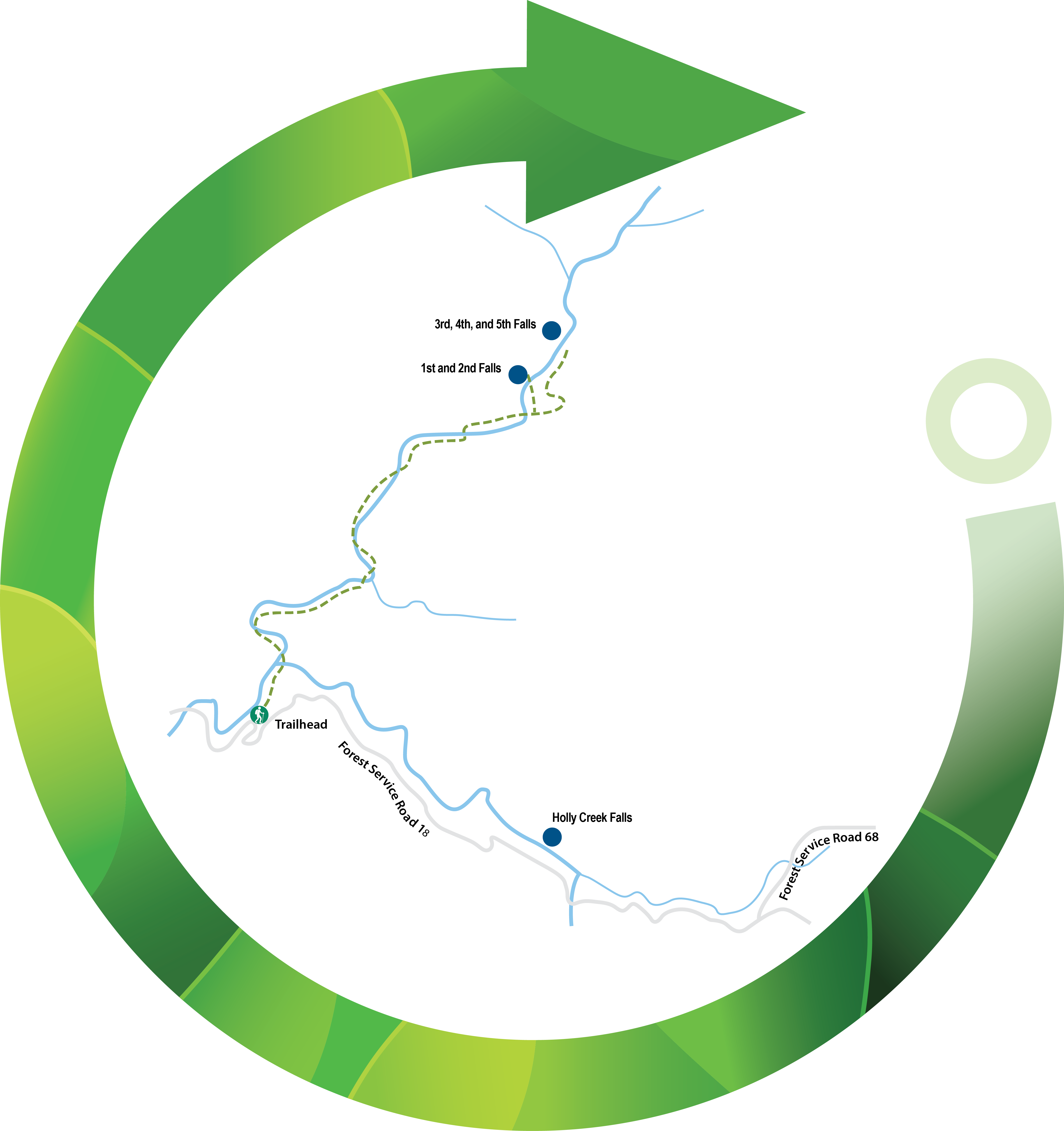
From Chatsworth, GA, take US 411 North for 6 miles to the town of Eton, GA. There you will turn right onto Old CCC Camp Road, following that for 7 miles. When you come upon the day use area on Holly Creek on your right, you will see the Emery Creek Trailhead parking area just beyond on the left where you can enter the trailhead.
There is an uphill walk from the trailhead and almost immediately you will enjoy a mid-sized mountain stream that encourages you to either cool off or throw in a fishing line. Trout have been caught in some of these deeper pockets of water.
At mile 0.2 you will make your first stream crossing, across Holly Creek. Continuing your hike, you will notice rhododendrons, mountain laurels, sweetgum, and white and chestnut oaks. At 0.4 mile you come upon a large rock outcropping.
There is no shortage of places to take a break if needed, between fallen trees and large stones where you can relax, replenish and marvel at the areas’ beauty. The old logging road in the area reveals a rusted-out vehicle or two abandoned through the years.
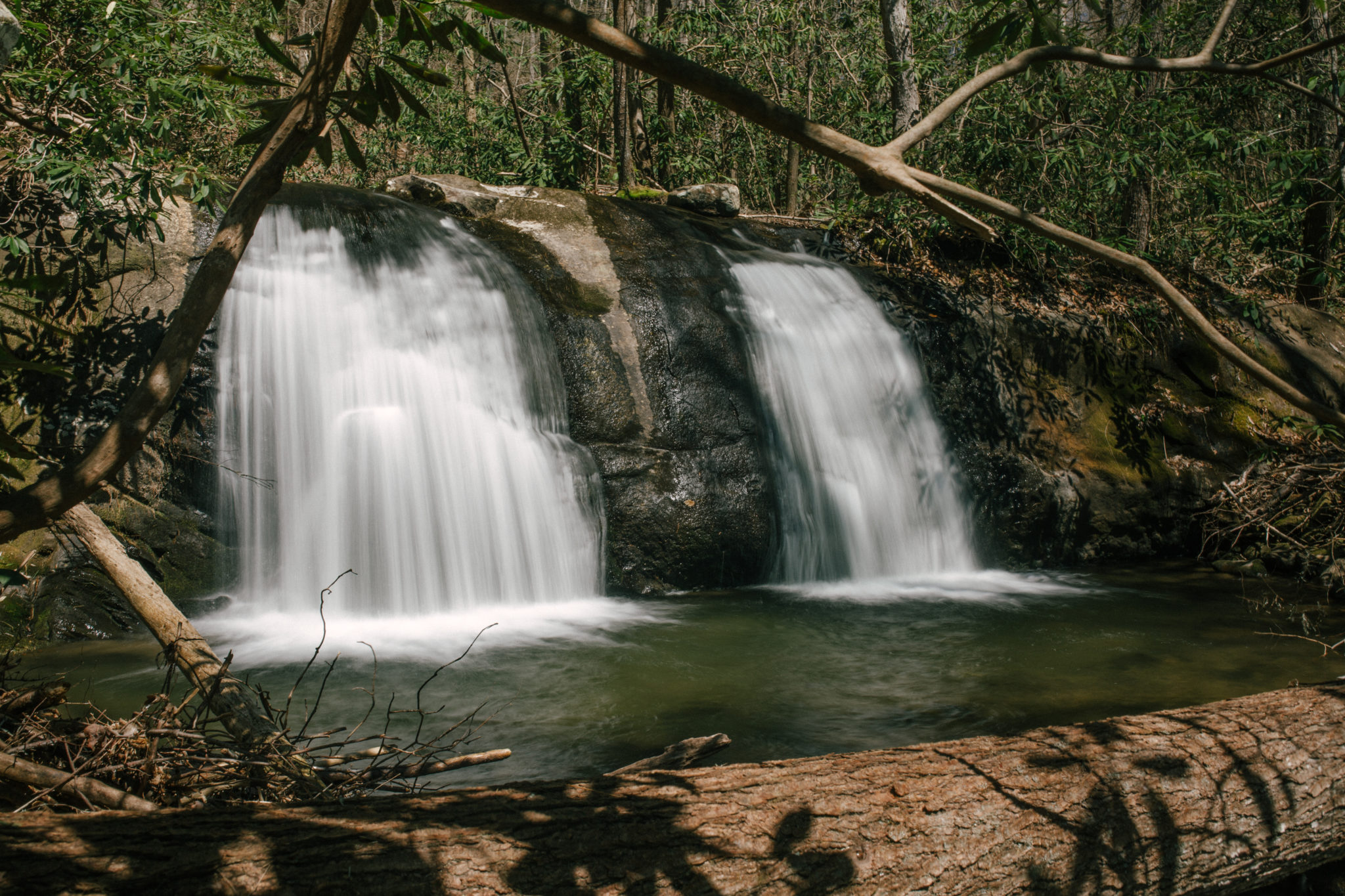
When you reach 1.3 miles, you will notice the trail widens as you turn right on the jeep road. In short order you will cross Emery Creek as the path narrows. Several rockier zigzags of the creekside path bring you to mile 2.2 where a sign for Emery Creek Falls will alert you it’s near. The 40-foot rock face will have made the trip worth the effort.
Back on the trail at mile 2.8, you will pass the final waterfalls on the left. From this point, the path ascends at a greater pace as the switchbacks lead you 1,500 feet higher from your start, on Little Bald Mountain. The northern trailhead is reached when you make it to Lake Conasauga Campground near Conasauga Lake Road. If you have thought ahead and have a ride or a vehicle in place, this will end your hike. If not, well, the good news is the return walk is all downhill.


 Distance: 6.4 out and back
 Difficulty: difficult
 Directions
; w.print(); )


 2 months ago


