Billed as one of South Georgia’s “best kept secrets,” this
park is known for agricultural history depicted at Heritage Farm, with log
cabins, a corn crib, tobacco barn, cane mill, and other exhibits. Children
enjoy feeding the park’s farm animals, which usually include goats, sheep,
chickens, pigs, and donkeys. Overnight accommodations include 50 tent, trailer
and RV campsites, cottages, and the Burnham House, an elegantly decorated
19th-century cabin perfect for romantic getaways.
The 1,511-acre park features a 4-acre lake, a section of Seventeen-Mile
River, and a boardwalk that winds through cypress swamp where rare and
endangered plants grow. Pitcher plants, shy indigo snakes and gopher tortoises
make their homes in this wiregrass community. Birding and nature photography
are exceptional, so bring your binoculars and camera.
For horse lovers, the park offers more than 13 miles of
equestrian trails. Ride-in campsites are primitive, offering exceptional
privacy surrounded by nature and a true campout feel. Drive-in campsites offer
nearby water spigots, pit toilets, grills, fire rings, and picnic tables.
Stables are not provided.
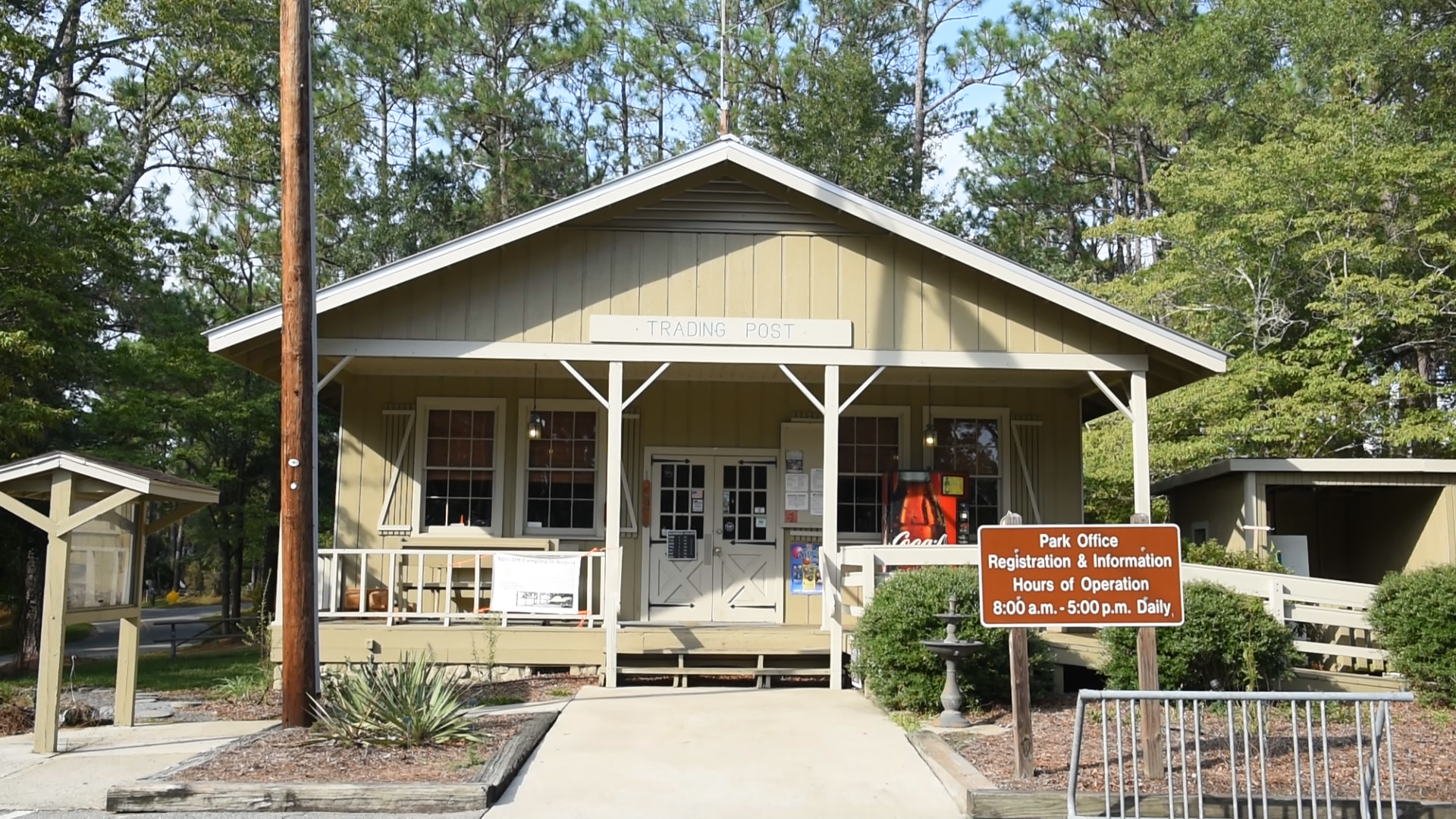
The park, which is in Nicholls, GA, was donated to the state
by a group of Coffee County citizens in 1970 and is named after General John
Coffee, a planter, U.S. Congressman and military leader.
PLEASE NOTE
Highway 158 between Waycross and Douglas will be closed at
the Satilla River Bridge until late 2020. Read below for suggested alternate
routes to take from Waycross to General Coffee State Park during the road
closure.
Alternate
Route #1
- Take Hwy 82 west out of Waycross to US 1
- Turn right unto US 1/Hwy 23 north to Alma
- In Alma, turn left onto Hwy 32 west toward
Nicholls
- The park’s main entrance will be on the right
about 6 miles west of Nicholls
Alternate
Route #2
- Take Hwy 82 west from Waycross to Pearson
- Turn right on Hwy 441 north to Douglas
- Turn right on Bowens Mill; go about 3 miles
- Turn right on Hwy 32 east
- The park’s main entrance will be on the left
around 6 miles east of Douglas
Recommended Trail: West River Swamp Trail to Gopher
Loop Trail
This out-and-back loop combines two of the parks most
popular trails, West River Swamp and Gopher Loop. The West River Trail is the
oldest trail in the park and travels along the western edge of the Seventeen-Mile
River from the picnic shelter #4 to campground #2 where it meets up with the
Gopher Loop.
From the trailhead, the pathway crosses several drainage
areas where wet weather creeks feed the river. The West River Swamp rises to
its highest point at 0.5 miles into the 1.35-mile trail. The pathway is
relatively compacted and easy to walk, but the trail can be narrow in places
with exposed roots, so use caution in these areas.
As you travel along this trail, you’ll be walking along the
ecotone, which is a boundary between two distinct habitats. This is a rare
hiking opportunity, so take note of the river habitat on one side and mostly
upland pine forest along the other side.
As you scan the river area along the trail, you’ll see a
mixture of cypress, black gum and red maple trees. Scattered within the river
are small islands that support pond pine and other species of trees and bushes.
The upland pine forest in this area is dominated by longleaf
pine and wiregrass. This is one of the two types of longleaf habitats seen at
General Coffee State Park. The other is the longleaf-turkey oak forest found in
the sandhill areas. These upland forests are home to many types of songbirds
and small mammals. During the spring and fall, these woods are full of native wildflowers.
This variety of plant life leads to wildlife that can live
in one habitat or both habitats. As you walk along the trail you may see or
hear songbirds, owls, hawks, raccoons, whitetail deer, snakes, and many other
animals. Trekking just after sunset on a summer evening, you may be treated to
a light show as fireflies rise from the riverbanks for their nightly mating
flight.
Follow West River Trail as it joins into Gopher Loop behind
campground #2 and make the 1-mile loop through the sandhill management area of
the park. Keep in mind, this is the driest area in the park, and during the
summer it can be very hot, so be sure to take water and a hat. It is along this
trail that you have the best chance of seeing the protected gopher tortoise and
the threatened indigo snake.
While you can take the loop clockwise or counter-clockwise,
we recommend bearing right at the intersection of the West River Trail and
taking the Gopher Loop counter-clockwise. The low point of Gopher Loop is
around 0.2 miles from the intersection and sits at around 171 feet above sea
level.
Over the 0.4 miles, the trail gains about 60 feet in
elevation. At the 2.0-mile mark, the trail levels out atop the sandhill ridge. Scattered
throughout the sandhills are many gopher tortoise colonies. Each colony usually
contains 10-15 burrows and is home to 10 or more tortoises. These burrows can
be over 30 feet in length and may be 6 or more feet below the sandy surface. When
walking around these burrows, be careful to not step on the apron or near the
tunnel entrance, as sometimes the beginning of the tunnel will collapse under
your weight. This species is the only tortoise in the Southeast and is an
important member of the sandhill community; preservation is the highest
priority.
A restoration project began in this sandhill area in 2005.
Designed to bring balance back to the system, the restoration project relies on
controlled burns and the growth of 25,000 longleaf pine seedlings. While this
arid landscape may look dry and desolate during the day, in the early morning
and late evening the environment is teeming with wildlife.
The crest of the Gopher Loop soon descends back toward the
West River Trail and you’ll bear left at the trail intersection to head back
the way you came, this time with the swamp habitat on your left and the sandhill
habitat on your right. If for some reason the trail is too buggy or wet on the
return trip, John Coffee Road runs parallel to the trail and can easily bring
you back to the starting point.
Other Trails to Check Out at General Coffee State Park
Equestrian Trails
The park features miles of horse trails that loop through
the eastern side of the property. Parking for horse trailers is available at
picnic shelter #7. All riders must check in at the park office before
proceeding to the trail area. A small fee is charged for use of horse trails
and proof of negative Coggins test is required on all horses.
Riders will experience every type of habitat present at
General Coffee State Park. The lower sandhill areas were clear-cut in the early
1970s and have re-grown as a mixed oak forest. Small sections of this area are
being used as experimental areas to study various sandhill restoration
techniques. The upper sandhill areas contain oaks and mature longleaf pine,
while the scrub area toward the back of the park is a rare glance at a unique
ecosystem. The trail crosses multiple drainage areas and travels along the edge
of the Seventeen Mile River and Otter Creek for several miles. The area is
filled with wildlife such as whitetail deer, wild turkey, gopher tortoise, and songbirds.
Trails include: Otter Creek Equestrian Trail (2.2
mi), River Equestrian Trail (4.8 mi), Yellow Jacket Equestrian Trail (1.6 mi)


 Distance: 3.7
 Difficulty: easy
 Directions


 2 months ago


