TRAILHEAD PROFILE
Laruen Tingler
Hiciunt est, sequas rem volorem aut apis etur minvelles recaborempos adipis dolor sim re nis
volor rerem rest, te ius. Pudaecullat quat volupis eaque quid et explaci enihil modis sunt
que vendis et in coneseq uissed quiae corio doles exerepe ribusda eptatus sit ius. Ipsam que
vel exceptas esedipsam et volorru ptatem nonsequunt. La et excearunto eosam faccae nobit.
Aexped quia soluptatus ipsaest eumqui od que etur, occuptatust moditiunte et aceribus,
vollia nobis sum simillitatis nias nobis diorem. Namus sandit exped quias explibe aquamus
dignatis estio te nonseque.


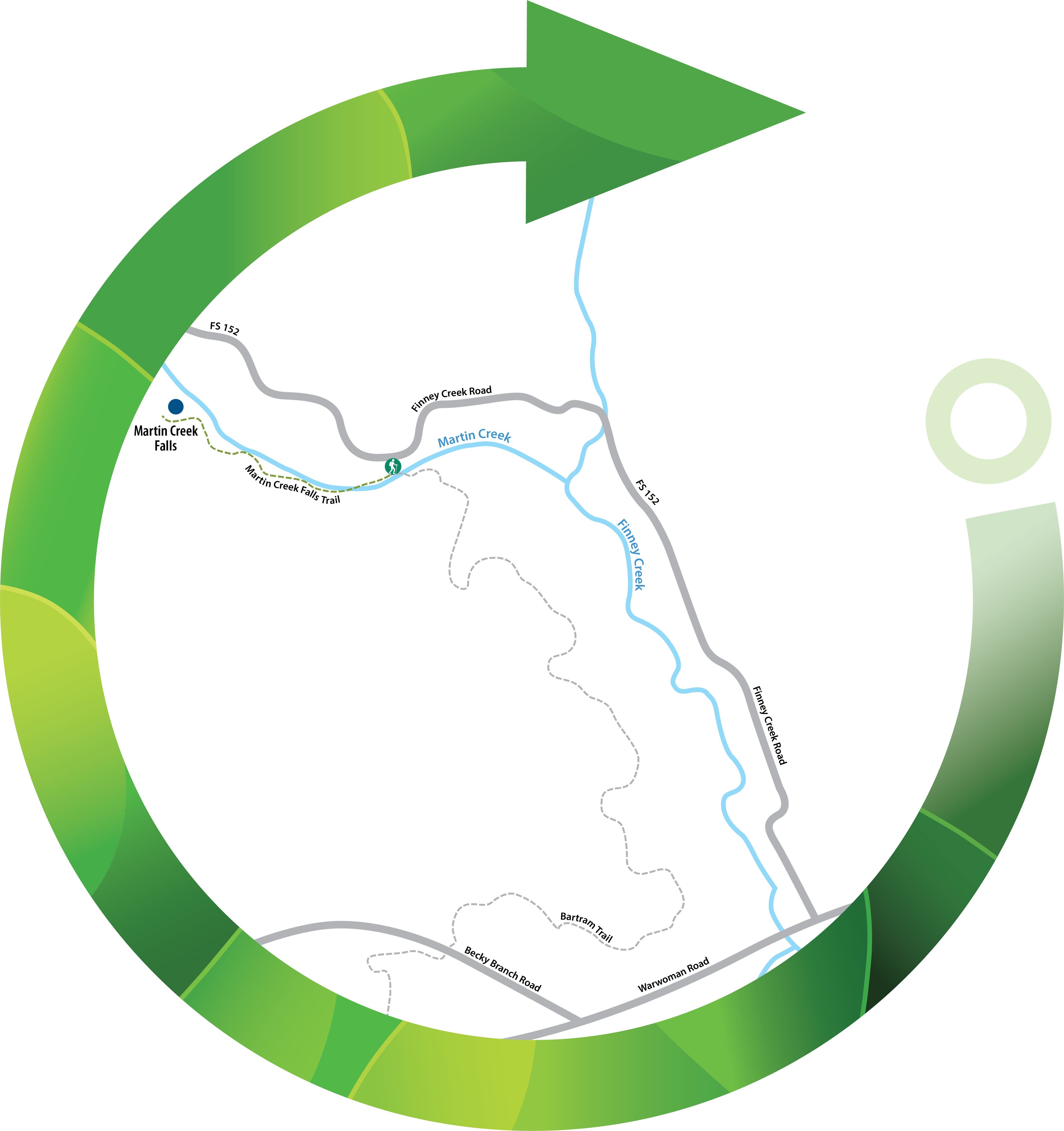
 Distance: 0.5 miles
 Difficulty: Easy
 Directions
; w.print(); )


 2 months ago


