With abundant parking and easy access just off Georgia State
Highways 17 and 75, 5 miles north of Helen, GA, this Appalachian Trail entry
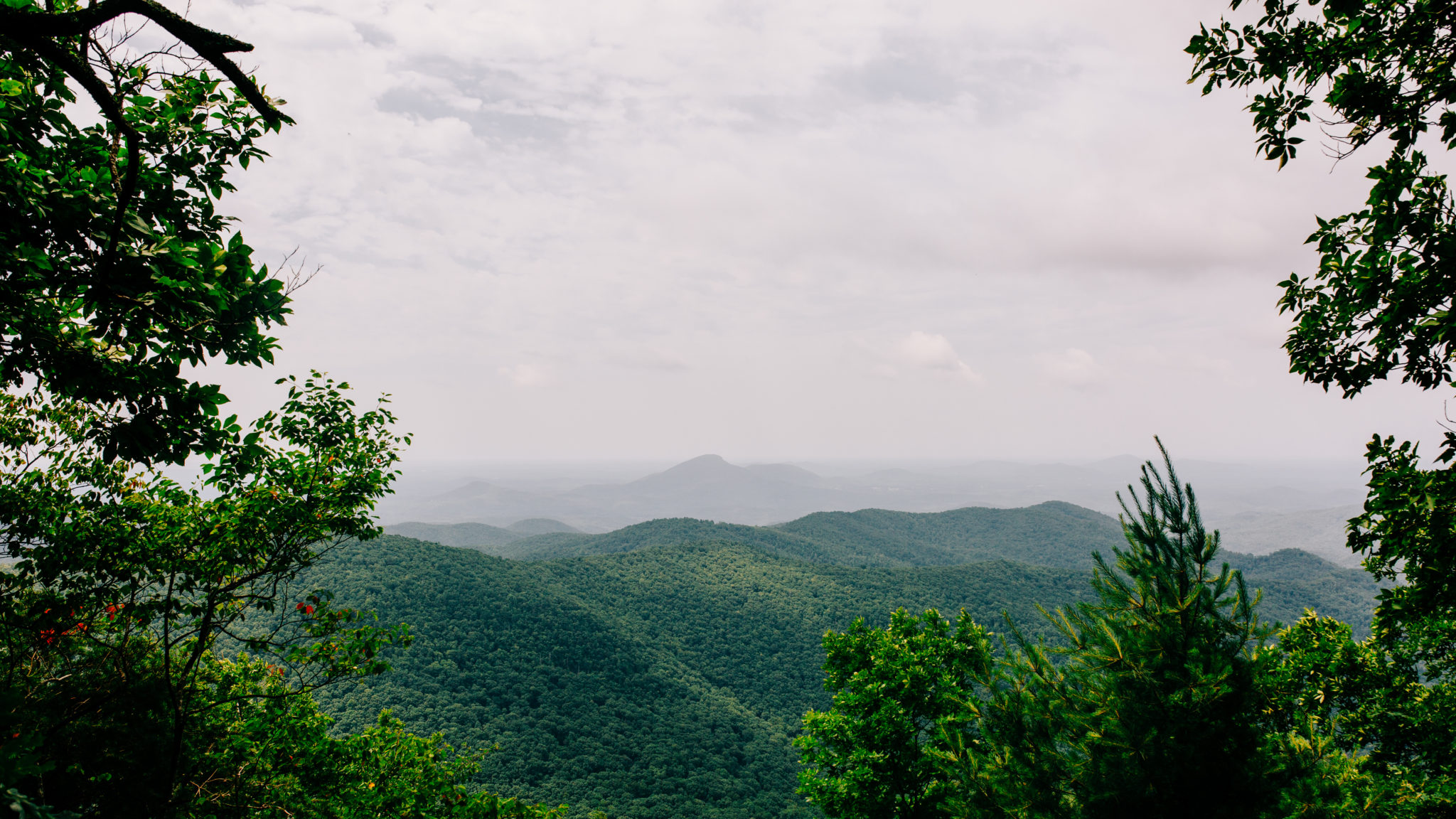
will test your mettle, but the rewards are worth the sweat. The spectacular
summit views from Rocky Mountain never disappoint, especially in the fall and
spring months.
This stretch of the Appalachian Trail is one of the most
popular in Georgia with over a 1,000-foot climb to the summit of Rocky Mountain.
It is also one of the most difficult stretches. The summit offers some
fantastic campsites just off the trail. The scenery isn’t too shabby either,
with ferns, moss, wildflowers, and an array of mountain creeks.
After gathering yourself at the summit, the hike takes a
downhill approach into laurel-covered Indian Grave Gap and proceeds through
lush forest on the mountain’s side, looping back to Unicoi Gap on the Rocky
Mountain Trail.
This hike departs from the Unicoi Gap trailhead north of
Helen marked with a large boulder and bronze plaque like the one atop Springer
Mountain at the southern terminus of the AT. The hike follows the AT east,
climbing tree-lined stairs to enter a rock-strewn forest. The trail begins a
steady climb of Rocky Mountain’s western slope, the switchbacks climbing to the
0.85-mile point. Near that point, you will be standing at the headwaters point
of the 147-mile-long Hiawassee River, which flows northward into North Carolina
and west from there to Tennessee.
Near the summit, the white-blazed Appalachian Trail
intersects with the blue-blazed Rocky Mountain Trail, the return route for this
loop hike. Stay on the AT, which will take a turn south.
By 1.3 miles, campsite opportunities will be found just off
the trail. From these areas near the summit you can catch distant views of
Yonah Mountain.
The hike follows the AT across the mountain’s summit, making
for incredible views and photo opportunities. Leaving the thinner forest near
Rocky Mountain’s peak, you will start the 850 -foot descent toward Indian Grave
Gap. Once again, ferns and forest dominate the scenery. At 2.6-miles the trail
meets the gravel-laden Indian Gap (Forest Service Road 283).
Following Forest Service Road 283 to the left or north for 0.5
miles, you will find the trail sign for the blue-blazed Rocky Mountain Trail
that will reconnect you to the west with the AT trail on the northwestern side
of Rocky Mountain. Enjoy the small stream crossings and the wildflowers dotting
the trail during the spring and summer months
The trail peaks again at 4.25 miles, when you reach a small
campsite and a junction with the AT. From the intersection, the hike follows
the AT west, descending through the forest to Unicoi Gap, making this hike a
little over 5 miles.


 Distance: 5.1
 Difficulty: difficult
 Directions


 2 months ago


