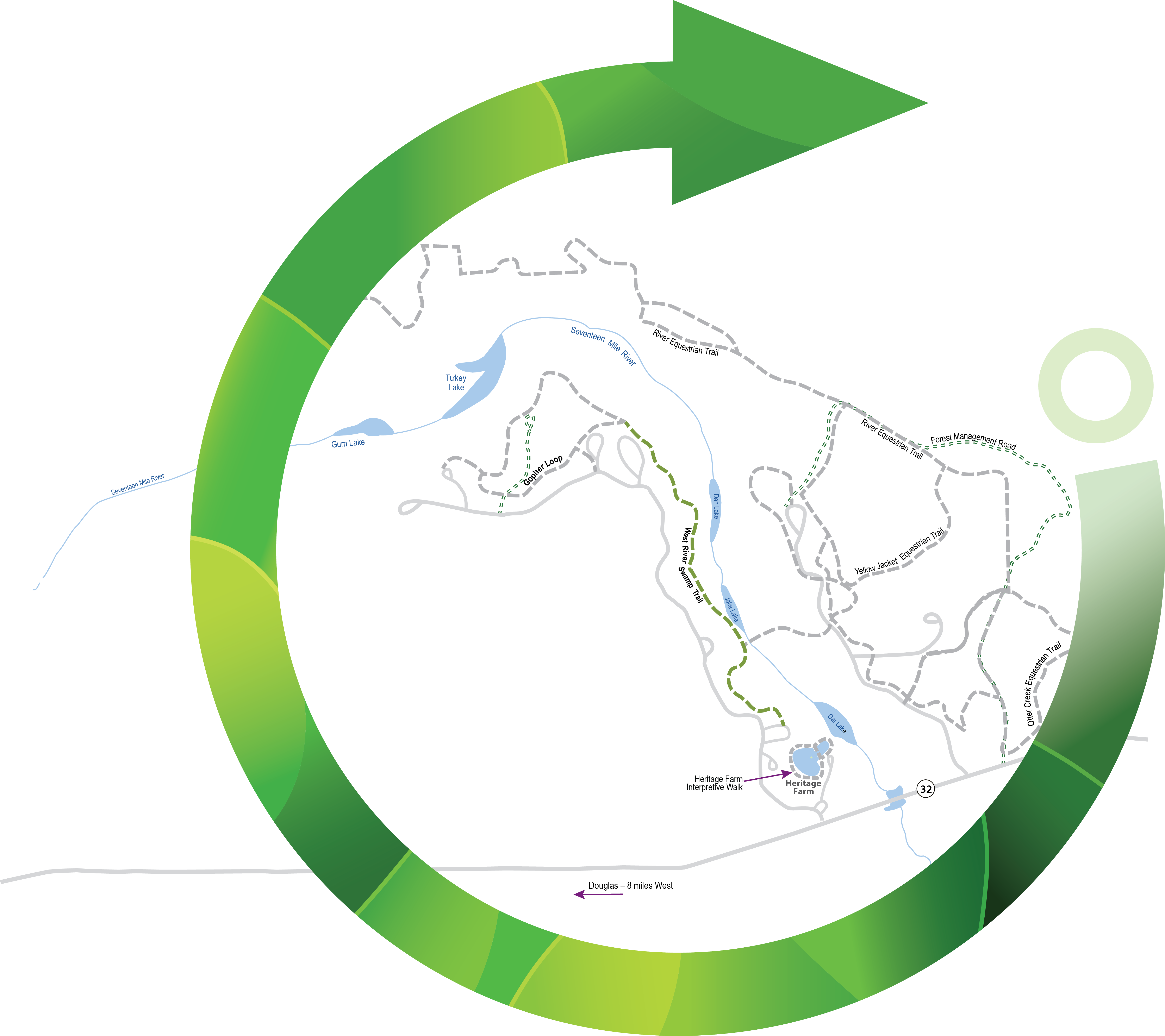
This out-and-back loop combines two of the parks most popular trails, West River Swamp and Gopher Loop. The West River Trail is the oldest trail in the park and travels along the western edge of the Seventeen-Mile River from the picnic shelter #4 to campground #2 where it meets up with the Gopher Loop.
From the trailhead, the pathway crosses several drainage areas where wet weather creeks feed the river. The West River Swamp rises to its highest point at 0.5 miles into the 1.35-mile trail. The pathway is relatively compacted and easy to walk, but the trail can be narrow in places with exposed roots, so use caution in these areas.
As you travel along this trail, you’ll be walking along the ecotone, which is a boundary between two distinct habitats. This is a rare hiking opportunity, so take note of the river habitat on one side and mostly upland pine forest along the other side.
As you scan the river area along the trail, you’ll see a mixture of cypress, black gum and red maple trees. Scattered within the river are small islands that support pond pine and other species of trees and bushes.
The upland pine forest in this area is dominated by longleaf pine and wiregrass. This is one of the two types of longleaf habitats seen at General Coffee State Park. The other is the longleaf-turkey oak forest found in the sandhill areas. These upland forests are home to many types of songbirds and small mammals. During the spring and fall, these woods are full of native wildflowers.
This variety of plant life leads to wildlife that can live in one habitat or both habitats. As you walk along the trail you may see or hear songbirds, owls, hawks, raccoons, whitetail deer, snakes, and many other animals. Trekking just after sunset on a summer evening, you may be treated to a light show as fireflies rise from the riverbanks for their nightly mating flight.
Follow West River Trail as it joins into Gopher Loop behind campground #2 and make the 1-mile loop through the sandhill management area of the park. Keep in mind, this is the driest area in the park, and during the summer it can be very hot, so be sure to take water and a hat. It is along this trail that you have the best chance of seeing the protected gopher tortoise and the threatened indigo snake.
While you can take the loop clockwise or counter-clockwise, we recommend bearing right at the intersection of the West River Trail and taking the Gopher Loop counter-clockwise. The low point of Gopher Loop is around 0.2 miles from the intersection and sits at around 171 feet above sea level.
Over the 0.4 miles, the trail gains about 60 feet in elevation. At the 2.0-mile mark, the trail levels out atop the sandhill ridge. Scattered throughout the sandhills are many gopher tortoise colonies. Each colony usually contains 10-15 burrows and is home to 10 or more tortoises. These burrows can be over 30 feet in length and may be 6 or more feet below the sandy surface. When walking around these burrows, be careful to not step on the apron or near the tunnel entrance, as sometimes the beginning of the tunnel will collapse under your weight. This species is the only tortoise in the Southeast and is an important member of the sandhill community; preservation is the highest priority.
A restoration project began in this sandhill area in 2005. Designed to bring balance back to the system, the restoration project relies on controlled burns and the growth of 25,000 longleaf pine seedlings. While this arid landscape may look dry and desolate during the day, in the early morning and late evening the environment is teeming with wildlife.
The crest of the Gopher Loop soon descends back toward the West River Trail and you’ll bear left at the trail intersection to head back the way you came, this time with the swamp habitat on your left and the sandhill habitat on your right. If for some reason the trail is too buggy or wet on the return trip, John Coffee Road runs parallel to the trail and can easily bring you back to the starting point.


 Distance: 3.7
 Difficulty: easy
 Directions
; w.print(); )


 2 months ago


